ACROSS
THE SUBASIO TO SPELLO,
of Giuseppe Bambini
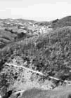
The following route on foot is definitely the most fascinating within the area and the length of the route (17 km, the total length (7 hours not including rests) and the effect of the difference in height (860 m uphill, 1,090 downhill) shall be rewarded by the different scenes of Assisi, the hermitage "l'Eremo delle carceri" and the Umbrian valley. The The view from the fields on the summit of the mountain sweeps across quaint Umbrian scenes extending as far as the harsh Sibillini Mountains. The route is also interesting from a naturalistic view point because of the "mortai", whilst the descent amidst the placid olive groves towards Spello's rooftops and crossing the picturesque town will remain an indelible memory. A little fitness is necessary for the walk and the route is quite well signposted (signposts white-red 50), in case of uncertainity consult the map and the description of the route. Comfortable mountain hiking clothes and shoes are advisable as well as a camera and binoculars. Other indispensible items include a backpack, water bottle, raincoat, bread roll, first-aid kit, compass and the map "Carta dei Sentieri del Monte Subasio (scale 1:20,000 of the C.A.I. section of Foligno). An altimetre could also be useful. The return journey will be by train departing from the Spello railway station (check the timetable), and once you get off at the station in Assisi you can get back to Piazza Matteotti by taking the ASP bus that leaves at every 10 minutes and 50 minutes past the hour. Have a good journey! ROUTE: from Piazza Matteotti (445m) go uphill along Via Santuario delle Carceri which within a short distance leads to the gate Porta Cappuccini (469m) built in the 14th century - also called gate Sant'Antonio - which is partly in ruins; under the arch traces of frescoes and the town's coat of arms can be seen. Soon after the arch turn left onto a tree lined path which runs parallel to the external walls of the fortress "la Rocchicciola"; from this point onwards to Spello follow the white-red 50 signposts.Once you arrive in Cassero take the rocky road right uphill, once past the drinking fountain at the fork do not take the left turn but continue along the road uphill that has thick woods on its right. At the next fork proceed straight on uphill along the path locally known as "il Trabocco". Once reached "Montarone" (800m) the path flattens out, avoid the deviation on the left and walk along a flat tract - on the right there are unique panoramas of Assisi and the Umbrian Valley - then the path after another short tract uphill, opens onto the "panoramic road" which you take right downhill. Struck at first by a stupendous sight - almost hidden amidst the thick woods of majestic holm-oaks and secular oaks - one arrives at the hermitage, "l'Eremo delle Carceri (792m -1.50 from the start), which must of course be visited. Once the visit is over, from the entrance walk a few metres along the road taken before and at the fork (indications for "San Benedetto - Bolsella") take the asphalted road on the right which turns and goes uphill over the hermitage and take the lovely path on the left (N) which is opposite a curve on the right, then on the right (S-E) cross fields to Vallonica (1059m - 0.50 from the hermitage) with a building belonging to the rangers. The Vallonica basin is a large valley of karst origin in the shape of a water shed with an elliptical perimetre, with the main axis directed N-E and with its effluent Fosso delle Carceri. The almost level grassy path proceeds through small valleys (S) until reaching "Croce di Sasso Piano (110m - 0.30 from Vallonica), a magnificent terrace over-looking the whole Umbrian Valley. The path proceeds constantly uphill towards E, it goes around the head of Fosso Rosceto and crosses the "panoramic road" (1270m) - near many antennas - proceed right along this road for a few hundred metres then take a grassy track left (gate) that leads within a short distance towards the obvious "hole" of the Mortaro (1240m - 0.50 from Croce di Sasso Piano) with its edge that is already visible in the distance; the peculiarity of this site definitely merits a stop. The most impressive karst phenomenons of Mount Subasio are made up of considerably large dolines - locally called "mortari" o "mortai" because they resemble mortars. They can be found scattered over the fields on the mountain summit, not less than 1000m in height, and they are erroneously thought to be ancient vulcanic craters now extinct. The "Mortaro grande" is the largest and deepest doline of the Subasio. The elliptical perimetre, has its longest axis measuring 280m in length and its edge does not have a constant altitude but on average it ranges from 50 to 70. The smaller "Mortaiolo" 70m in diametre is adjacent to the "Mortaro grande", in direction N-E. About 20 metres downhill towards the valley there is a third doline, however, this time its flat, that is much wider than deep and in spring it seems an overgrown garden filled with multicoloured flowers. Bypass the Mortaro Grande by following the signpost 50 and proceeding along an almost flat track (S) you come across an animal drinking trough (1228m). Turn right (W-S-W) towards the nearby "panoramic road" that you then cross keeping the direction; a little after the path turn left (S-E) and after descending a steep winding road you reach Fonte Bregno (1028m - 0.30 from the Mortaro Grande), a pleasant place for a rest. This is the spring found at the highest altitude on Mount Subasio, and a mountain road runs along it that in ancient times linked Assisi to Spello; the administrative borderline divides the road in two, that can be seen by the two coat of arms of the two towns placed up high on the side of the spring. Take the path (S-E) right in front of the Fonte Bregno that descends along steep winding tracks into the wood, that then crosses the deep watershed "Fosso Renaro", then flattens out reaching a junction between ranger service roads with a gate (700m). Proceeding (S) along the path downhill you come across another dirt road that you cross. After proceeding along the path for a short distance you come to a lovely dirt road that you take downhill (S-W) reaching Fonte Bulgarella (310m - 2.10 from Fonte Bregno), where the signpost 50 ends. At the end of the long descent there is a marvellous panorama of Spello and the valley of the Torrente Chiona. The characteristic pyramid of Sasso di Pale (E) and the long chain of the Brunette (S-E) can be well seen. Continue downhill along an asphalt road, at the 1° junction go straight on, at the 2° junction turn left and once you go through the gate "Porta Montanara" you enter the historic centre and into the square Piazza Vallegloria. In the square stands the Romanesque-Gothic church, Chiesa di Vallegloria (14th cent.) with a large rose. Proceed along via Guilia and at the junction with Via Arco d'Augusto (on the left by the roadside there is a frescoed shrine "Madonna con Bambino e Santi") there are some remains of a Roman gate called Arco d'Augusto. Proceed along Via Garibaldi where on the left is the church of San Lorenzo (1120). At the sides of the central portal there are two Roman funerary inscriptions. Proceeding downhill you reach the church of Sant'Andrea (13th cent.) that has a simple Romanesque portal. A little further down on the left is the church of Santa Maria Maggiore (13th cent.) that had its facade re-built in 1644. Proceeding along Via Consolare you go past the Roman gate "Porta Consolare" - a perfectly constructed square piece of architecture - and leave the historic centre; take Via Marconi and within a short distance you reach Spello's railway station (219m - 0.30 from Fonte Bulgarella) where you can catch the train back to Assisi (journey time 0.10 mins - ticket £ 1,500) then take the ASP bus (journey time 0.15 mins. ticket £1,200) and you arrive at Piazza Matteotti again. Mount Subasio is really great!